德克萨斯州的风暴云
(原标题: Storm Cloud Over Texas)
2024-08-06
浏览次数: 18
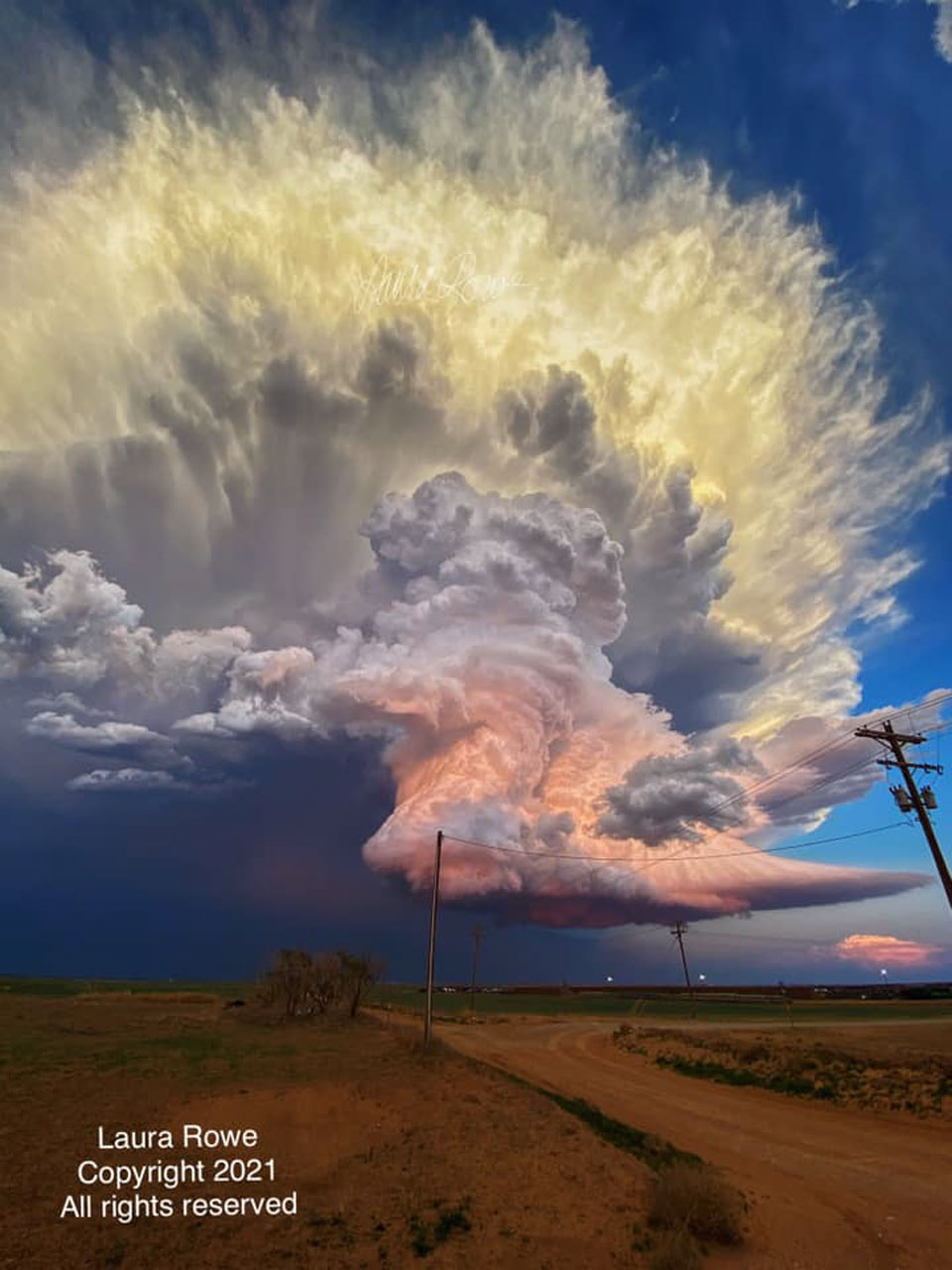
是什么让这片风暴云如此五彩缤纷?首先,云本身是由数以百万计的小水滴和冰组成的。它的底部几乎完全是平的——但这并不罕见。云层底部平坦通常是由于上升时气温下降造成的,在特定高度以上,水饱和的空气凝结出水滴。云中部的形状是由一股充满水滴的气柱向上吹造成的。然而,最不寻常的是橙色和黄色。这两种颜色都是由云层的水滴反射阳光造成的。云层中部和底部的橙色是晚霞近乎红色的反射。相比之下,云层顶部的黄色是由于尚未落下的太阳反射的光,其中一些(但较少)蓝光被散射掉了。这张令人印象深刻的动态积雨云图像似乎漂浮在德克萨斯州的平原上,是在2021年调查龙卷风时拍摄的。
查看原文解释
What makes this storm cloud so colorful? First, the cloud itself is composed of millions of tiny droplets of water and ice. Its bottom is almost completely flat -- but this isn't unusual. Bottom flatness in clouds is generally caused by air temperature dropping as you go up, and that above a specific height, water-saturated air condenses out water droplets. The shape of the cloud middle is caused by a water-droplet-laden column of air being blown upward. Most unusual, though, are the orange and yellow colors. Both colors are caused by the cloud's water drops reflecting sunlight. The orange color in the cloud's middle and bottom sections are reflections of a nearly red sunset. In contrast, the yellow color of the cloud's top results from reflection of light from a not-yet-setting Sun, where some -- but less -- blue light is being scattered away. Appearing to float above the plains in Texas, the featured impressive image of a dynamic cumulonimbus cloud was captured in 2021 while investigating a tornado.
© Laura Rowe (Used with permission)