Jyväskylä in the Sky
2024-01-25
浏览次数: 12
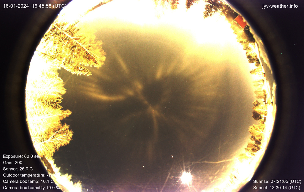
你可能不会马上认出这张街道地图,它是地球上芬兰Jyväskylä的一个社区。但这可能是因为这张地图是在1月16日被投影到夜空中,并用全天相机拍摄的。那个北方冬夜的气温记录在零下20摄氏度左右。当冰晶在头顶的大气中形成时,路灯将照明洒向天空,产生了可见光柱,由于飘动的晶体平面的镜面反射,它们的空灵外观。当然,投影的灯柱描绘出灯火通明的当地街道的地图,尽管在向上看的摄像机视图中是从右到左颠倒的。这张灯柱街道地图在Jyväskylä的夜晚盘旋了好几个小时。
查看原文解释
You might not immediately recognize this street map of a neighborhood in Jyväskylä, Finland, planet Earth. But that's probably because the map was projected into the night sky and captured with an allsky camera on January 16. The temperature recorded on that northern winter night was around minus 20 degrees Celsius. As ice crystals formed in the atmosphere overhead, street lights spilling illumination into the sky above produced visible light pillars, their ethereal appearance due to specular reflections from the fluttering crystals' flat surfaces. Of course, the projected light pillars trace a map of the brightly lit local streets, though reversed right to left in the upward looking camera's view. This light pillar street map was seen to hover for hours in the Jyväskylä night.
© Harri Kiiskinen