威斯康辛州上空翻滚的云
(原标题: A Roll Cloud Over Wisconsin)
2023-08-20
浏览次数: 17
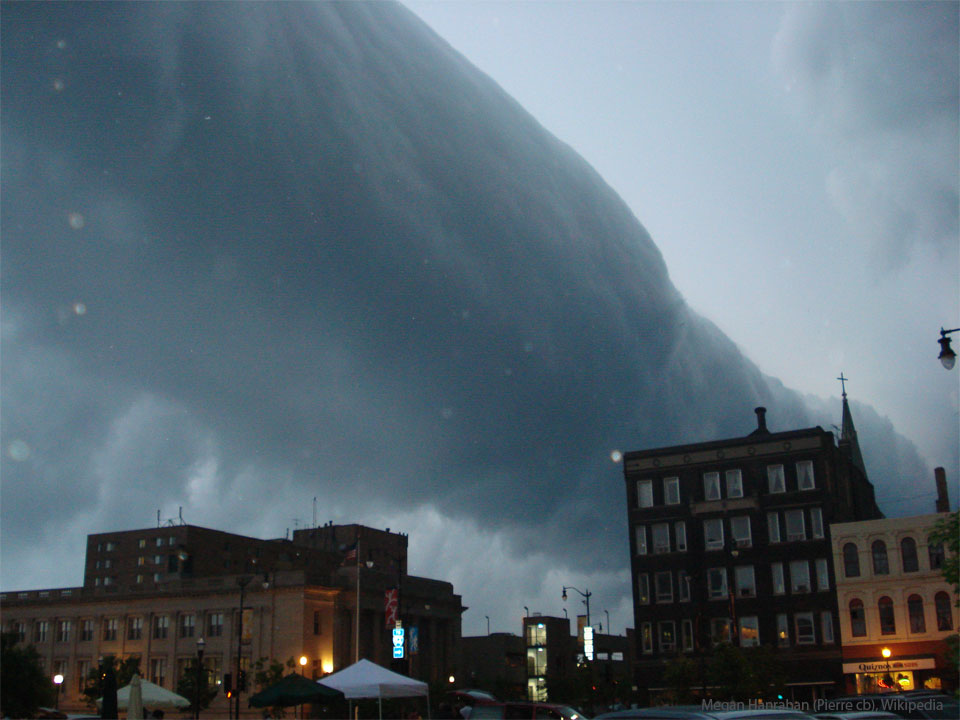
这是什么云?一种叫做卷云的弧形云。这些罕见的长云可能在前进的冷锋附近形成。特别是,来自前进的风暴锋面的下沉气流会导致潮湿的暖空气上升,在露点以下冷却,从而形成云。当这种情况沿着延伸的锋面均匀发生时,就可能形成卷云。卷云实际上可能有空气沿着云的长水平轴循环。卷云被认为不可能演变成龙卷风。与类似的架状云不同,卷状云完全脱离了它们的母体积雨云。图为2007年美国威斯康辛州拉辛市,一团翻滚的云在风暴逼近时向远处延伸。
查看原文解释
What kind of cloud is this? A type of arcus cloud called a roll cloud. These rare long clouds may form near advancing cold fronts. In particular, a downdraft from an advancing storm front can cause moist warm air to rise, cool below its dew point, and so form a cloud. When this happens uniformly along an extended front, a roll cloud may form. Roll clouds may actually have air circulating along the long horizontal axis of the cloud. A roll cloud is not thought to be able to morph into a tornado. Unlike a similar shelf cloud, a roll cloud is completely detached from their parent cumulonimbus cloud. Pictured here, a roll cloud extends far into the distance as a storm approaches in 2007 in Racine, Wisconsin, USA.