月球南极的阴影
(原标题: Shadows at the Moon's South Pole)
2022-04-10
浏览次数: 29
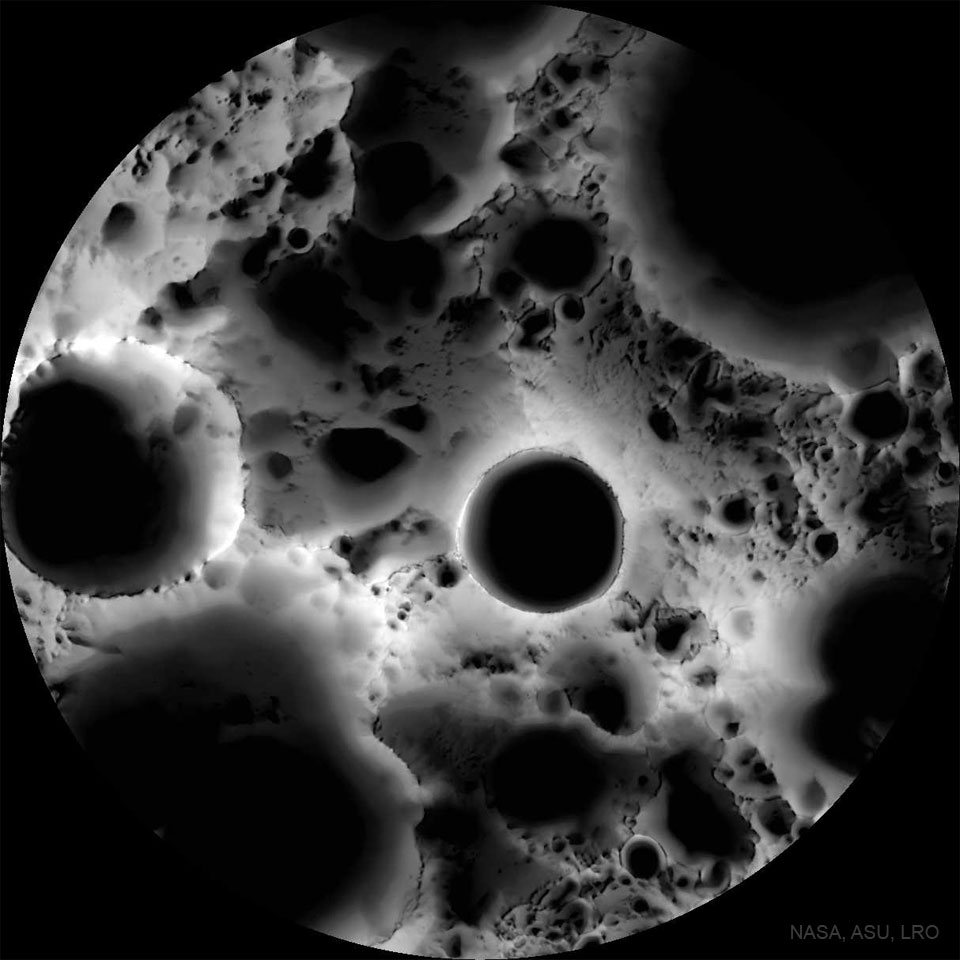
这张月球表面的照片是用显微镜拍的吗?不,这是一张用广角相机制作的多时间照明地图。为了创造它,月球勘测轨道飞行器在6个月球日(6个地球月)的时间里收集了1700张图像,从不同的角度反复覆盖了以月球南极为中心的区域。将得到的图像叠加在一起,形成一张特色地图——代表表面上每个点被太阳照射的时间百分比。在地图中心附近,可以看到直径19公里的沙克尔顿陨石坑的底部,令人信服地隐藏在阴影中。月球南极本身在9点钟方向的陨石坑边缘。月球南北两极附近的陨石坑底部可以永远处于阴影中,而山顶可以保持几乎连续的阳光。对未来的前哨站很有用,阴影笼罩的火山口底部可以提供水冰的储存库,而阳光照射的山顶则提供了收集太阳能的好地方。
查看原文解释
Was this image of the Moon's surface taken with a microscope? No -- it's a multi-temporal illumination map made with a wide-angle camera. To create it, the Lunar Reconnaissance Orbiter spacecraft collected 1,700 images over a period of 6 lunar days (6 Earth months), repeatedly covering an area centered on the Moon's south pole from different angles. The resulting images were stacked to produce the featured map -- representing the percentage of time each spot on the surface was illuminated by the Sun. Remaining convincingly in shadow, the floor of the 19-kilometer diameter Shackleton crater is seen near the map's center. The lunar south pole itself is at about 9 o'clock on the crater's rim. Crater floors near the lunar south and north poles can remain in permanent shadow, while mountain tops can remain in nearly continuous sunlight. Useful for future outposts, the shadowed crater floors could offer reservoirs of water-ice, while the sunlit mountain tops offer good locations to collect solar power.